Subsurface Utility Investigation & Engineering
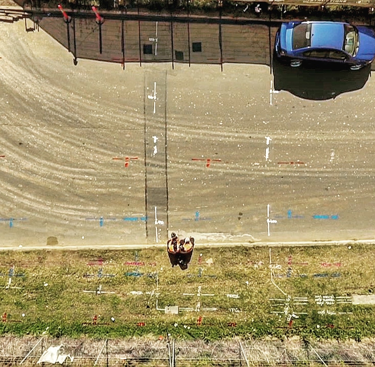
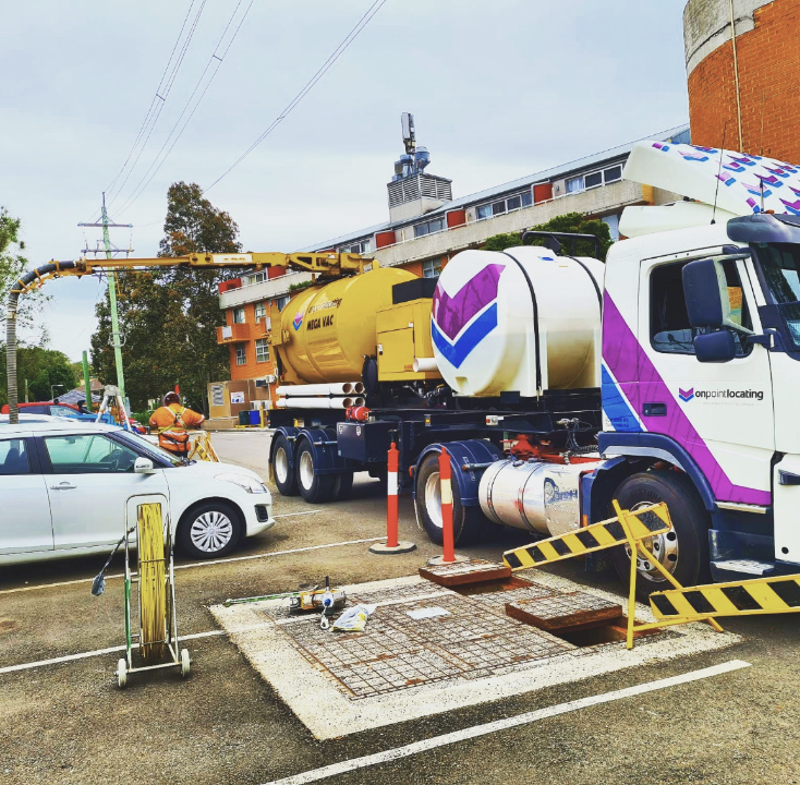
Subsurface Utility Engineering (SUE) is a discipline of civil engineering that involves the investigation of buried utilities and identifies the conflicts they may pose to a project design in order to mitigate associated risks. These risks are identified through utility owner record drawings, geophysical methods to locate a utility’s horizontal position, vacuum excavation to pinpoint the vertical position, and the survey of this data referenced into a topographic map or various other types of mapping.
Subsurface Utility Investigation
SUE uses a series of four quality levels (QLs):
QL-D involves gathering record data, which may include digital records, paper records, internet searches, or site inspection.
QL-C entails surveying visible above-ground utility features, such as manholes, valve boxes, utility marker posts, and more. This information is then correlated with existing utility records.
QL-B determines the existence and horizontal position of underground utilities using surface geophysical techniques. This level also includes obtaining two-dimensional mapping information, which aids in decision-making for design, utility relocations, and installations.
QL-A is the highest and most effective SUE level presently available. Non-destructive digging equipment is used to determine the precise horizontal and vertical position of underground utilities. When surveyed and mapped, precise plan and profile information is available for design decisions and justification.
QLs are used to convey the level of confidence and the methods employed to determine a utility’s position. Once the QL has been determined, the SUE work has been performed, and a computer-aided design (CAD) file has been created depicting the best-known position of the utilities, a conflict matrix is produced to determine if utility relocation is needed for the project to be successful. Identifying the risks, including conflicts, in the matrix before a project starts is vital to the planning and design phases of a project.
To get a quote Email or Call us Anytime!
Call us today:
or
Email us at
Portfolio
Our Latest Projects.
Contact our expert teams today for your free initial site inspection and to discuss the Air.
All
Carpenter
Genarel
Repair
Testimonial
We offer expert bespoke bath room fitting service, including major project

“Great service when we were in a real mess.With our drains completely blocked, we were lucky to hit upon to Fastclear, who rearranged their work schedule to get us quicker.”
Alfred Bonaport
CEO & Founder

“Great service when we were in a real mess.With our drains completely blocked, we were lucky to hit upon to Fastclear, who rearranged their work schedule to get us quicker.”
Alfred Bonaport
CEO & Founder

“Great service when we were in a real mess.With our drains completely blocked, we were lucky to hit upon to Fastclear, who rearranged their work schedule to get us quicker.”
Kim Jenifer
CEO & Founder

“Great service when we were in a real mess.With our drains completely blocked, we were lucky to hit upon to Fastclear, who rearranged their work schedule to get us quicker.”
Alfred Bonaport
CEO & Founder

Faq
General Questions
We love small plumbing jobs!!! We have plumbers on the road local to you who can complete your small plumbing.
What is the standard delivery time?
Delivery time-frame can vary depending on the items you have ordered and/or the address specified for delivery. On average, Standard Pallet deliveries are delivered within approximately 2-7 working days from when an order is placed.
Do you offer a next day delivery service?
Delivery time-frame can vary depending on the items you have ordered and/or the address specified for delivery. On average, Standard Pallet deliveries are delivered within approximately 2-7 working days from when an order is placed.
Do you offer an installation service?
Delivery time-frame can vary depending on the items you have ordered and/or the address specified for delivery. On average, Standard Pallet deliveries are delivered within approximately 2-7 working days from when an order is placed.
What is your two person white glove service?
Delivery time-frame can vary depending on the items you have ordered and/or the address specified for delivery. On average, Standard Pallet deliveries are delivered within approximately 2-7 working days from when an order is placed.
Latest News
Our Latest News
Contact our expert teams today for your free initial site inspection and to discuss the Air.
Why Firms Reputation Management Companies
Boiler fault call outs are on the rise, the cold weather is really setting [...]
How to prevent the frozen condense pipe?
Boiler fault call outs are on the rise, the cold weather is really setting [...]
What is the Difference Bet ween Air Conditioing
Boiler fault call outs are on the rise, the cold weather is really setting [...]
How to prevent the frozen condense pipe?
Boiler fault call outs are on the rise, the cold weather is really setting [...]


